Surveys
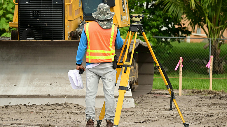
RICONS GENERAL SERVICES prides itself in offering our Clients & Customers high quality, Topographical Surveys, Hydrogeological Surveys, Geological Mapping Hydrological and Meteorological Survey Services solutions through a combination of qualified/experienced personnel and cutting-edge service technological modern equipment and Latest Software applications. Professional areas of engagement comprise Topographical Surveys, Hydrogeological Surveys, Geological Survey, and Meteorological Survey Since establishing we have spent the past years building a worldwide network of consulting Geomatics Experts, Meteorologists, Land Surveyors, Physical Planners, Hydrologists, Sociologists and Environmental Experts. Our goal has always been to help you find the best consultant solution, and expert advice you need, when you need it the most. GIS SOLUTIONS: We do offer practical and up to date GIS (Geographical Information Systems) solutions with incorporation of graphical and tabular data for better assessment and understanding of real-world problems for all our clients. Our firm has a pool of registered professionals which include Geomatics Experts, Meteorologists, Land Surveyors, Physical Planners, Hydrologists, Sociologists and Environmental Experts. The firm and the professionals are registered with various professional and licensing authorities, such as the Physical Planners Registration Board, Institution of Surveyors, and National Environmental Management Authority, Geological surveys. Endowed with a Modern state of the art Surveying and Mapping instruments which range from Drones, GNSS Receivers (RTK), Marine Echo Sounders, Lidar, Ground Penetrating Radar (GPR), Total Stations, Digital and auto Levels. Our professionals are proficient with all mapping’s software in their line of expertise which gives us an edge in timely Delivery of services.
Get in TouchRelated Services


Copyright © Ricons General Services , All Right Reserved.
Developed By Favione